

See It. Dive It. Fish It.
CMOR Mapping’s game-changing, high-resolution bathymetric imagery for Simrad, Lowrance, Raymarine, and Furuno chartplotters and Mercury VesselView displays brings the ocean floor into an entirely new level of focus for anglers and divers.
Complete Coverage
CMOR Mapping data comes from methodical surveys of the entire bottom with high-resolution echosounders — not point soundings and historical records.
Unprecedented Detail
With resolution as high as 1 meter — meaning each pixel equals a square meter of bottom — we show you every ledge, coral head, and sunken culvert in unprecedented detail.
Seamless Compatibility
Just insert a CMOR Mapping card into your plotter and zoom in to see bathymetric imagery. Your vessel icon shows your exact location relative to bottom features.
Current Coverage Areas
Please note that resolution of map overlays has been intentionally degraded. See our Sample Imagery page for full-resolution captures.
CMOR Cards
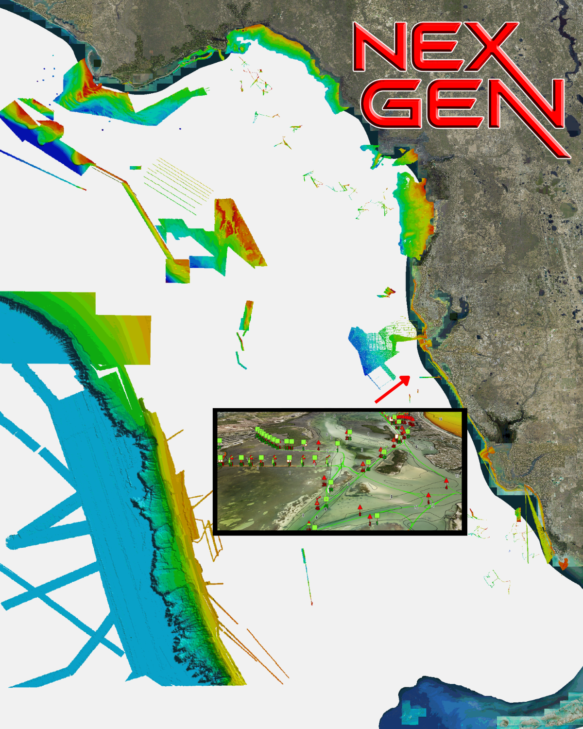
The new West Florida V3 NEX GEN 3D Relief Shading CMOR Card — a major expansion and update of the previous West Florida (Middle Grounds) CMOR Card — features major expansions of nearshore and deep drop spots, along with privately collected data from the St. Joseph Peninsula in the panhandle to Marco Island in southwest Florida. These additions have been mapped in high resolution for the first time, and exclusively on CMOR Mapping.
CMOR NEX GEN transcends traditional mapping by combining ultra-high resolution bathymetric imagery with full navigational data and aerial imagery — so whether you’re fishing, diving, or safe-navigating, everything you need is visible at a glance.
Visualize wrecks, reefs, artificial structure, and bottom contours while simultaneously seeing buoys, speed routes, bridges, and marinas — all tied in with the latest aerial imagery of shorelines and shallow water.
All CMOR Cards with the exception of Furuno are provided on Micro SD cards with a standard SD adapter included.
Furuno customers: Instead of a physical card, you will receive an unlock code to access CMOR imagery on your device. Your NavNet system ID is required in order to generate the unlock code.
Raymarine customers: Nex Gen is only compatible on Axiom + / Axiom 2 + / Axiom Pro / Axiom Pro 2 units.
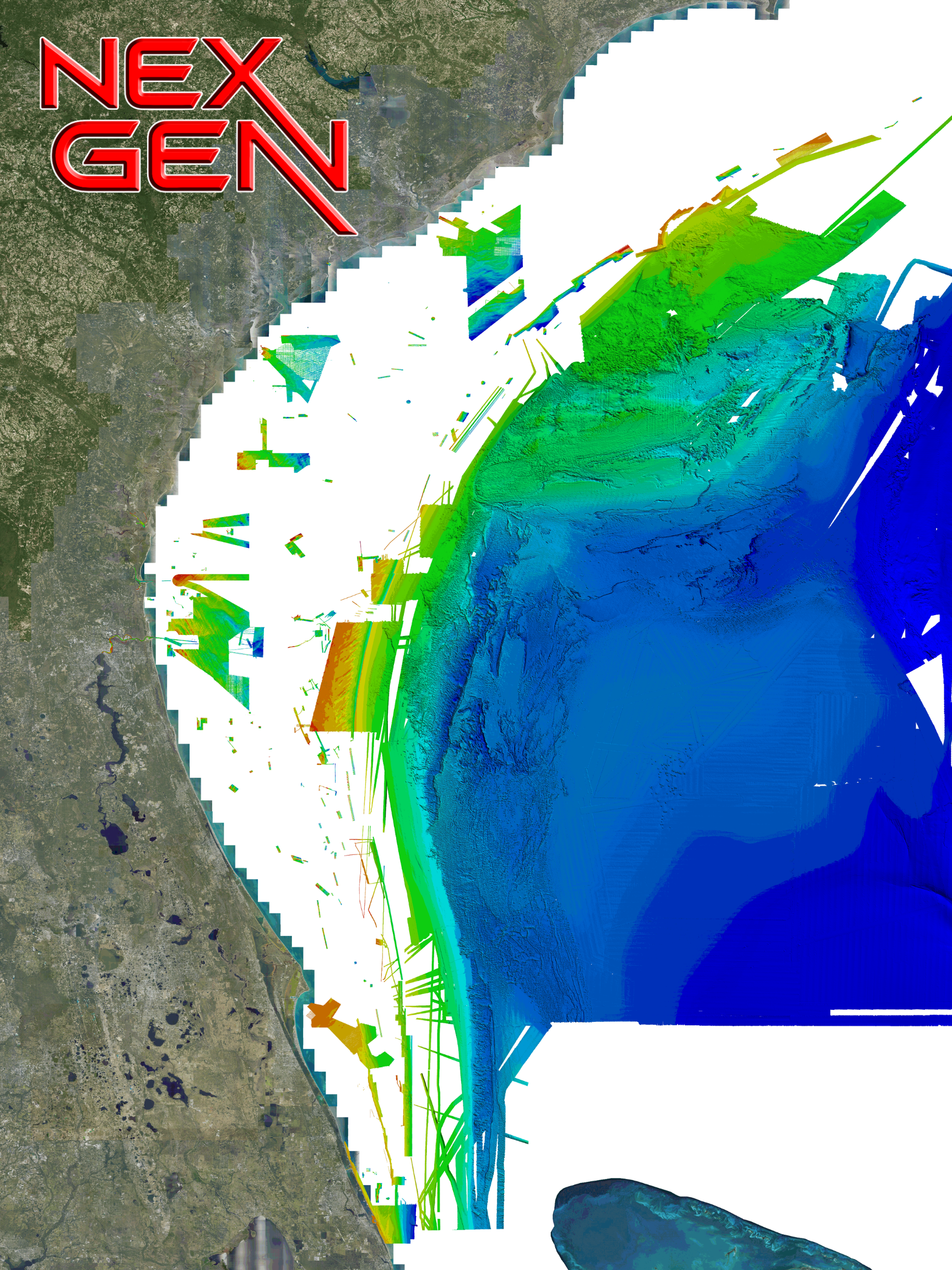
CMOR NEX GEN South Atlantic V2 COMPLETE MARINE VIEW a massive expansion of private data along with a full navigation chart throughout the coast and covers of some of the best fishing, diving, and deep dropping spots in the Atlantic Ocean. This chart has coverage from Stuart Florida up through South Carolina. Release Date 3/24/26.
CMOR NEX GEN transcends traditional mapping by combining ultra-high resolution bathymetric imagery with full navigational data and aerial imagery — so whether you’re fishing, diving, or safe-navigating, everything you need is visible at a glance.
Visualize wrecks, reefs, artificial structure, and bottom contours while simultaneously seeing buoys, speed routes, bridges, and marinas — all tied in with the latest aerial imagery of shorelines and shallow water.
All CMOR Cards with the exception of Furuno are provided on Micro SD cards with a standard SD adapter included.
Furuno customers: Instead of a physical card, you will receive an unlock code to access CMOR imagery on your device. Your NavNet system ID is required in order to generate the unlock code. Also, please note that South Atlantic is not yet available for Furuno is it is in the processing stage.
Raymarine customers: Nex Gen is only compatible on Axiom + / Axiom 2 + / Axiom Pro / Axiom Pro 2 units.
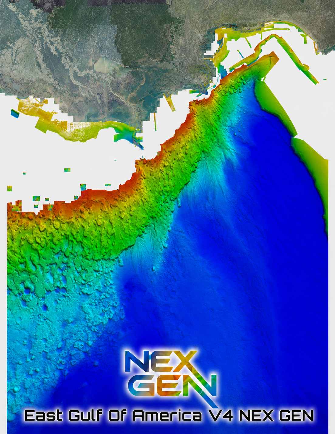
Introducing East Gulf of America V4 NEX GEN — our newest generation of CMOR Mapping for the East Gulf.
V4 combines CMOR’s high-resolution offshore mapping with our latest NEX GEN features, giving anglers and divers more information on the water and an entirely new way to explore the East Gulf.
What’s New with V4 NEX GEN
Ultra High-Resolution Bathymetry
Updated CMOR Mapping Data
2025 Satellite Imagery
Navigation Aids & Icons
Named Wrecks & Reefs
Bridges & Marinas
Toggle Between CMOR Mapping & Satellite Imagery
Enhanced NEX GEN Interface & Features
Whether you’re searching for structure, planning your next fishing trip, or exploring new dive sites, V4 gives you more information before you ever drop a line or hit the water.
SEE IT. DIVE IT. FISH IT.
The East Gulf of America V4 3D Relief Shading CMOR Card includes a massive nearshore and deep drop addition throughout the entire map, a highly detailed NOAA pipeline map with platform indicators, new inlet and shoreline coverage, wrecks, chicken coops, sound / bay coverage, Mississippi River and more! The East Gulf of Mexico v3 3D Relief Shading CMOR Card offers unbeatable coverage and resolution for targeting everything from nearshore snapper to daytime swordfish.
All CMOR Cards with the exception of Furuno are provided on Micro SD cards with a standard SD adapter included.
Furuno customers: Instead of a physical card, you will receive an unlock code to access CMOR imagery on your device. Your NavNet system ID is required in order to generate the unlock code.
Furuno Customers: Nex Gen is not yet available for Furuno as it is in the processing stage.
Raymarine Customers: Nex Gen is not yet available as it is in the processing stage.
Simrad NSX / NSS4 Customers: Nex Gen is not yet available as it is in the processing stage.
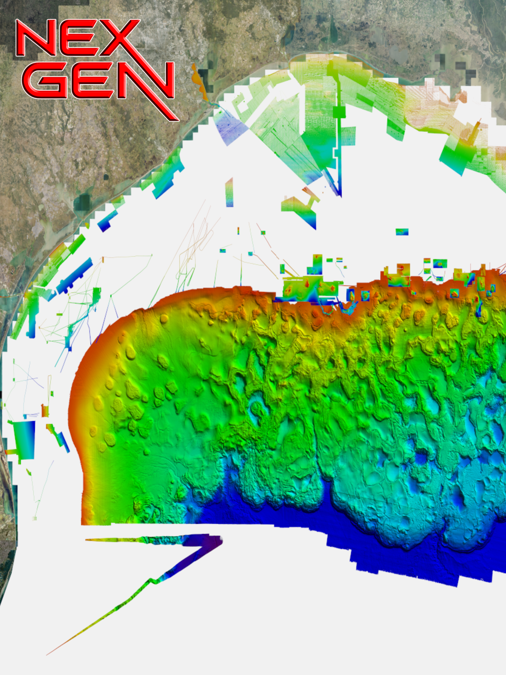
Introducing West Gulf of America V3 NEX GEN — our newest generation of CMOR Mapping for the West Gulf.
V3 combines CMOR’s high-resolution offshore mapping with our latest NEX GEN features, giving anglers and divers more information on the water and an entirely new way to explore the West Gulf.
What’s New with V3 NEX GEN
Ultra High-Resolution Bathymetry
Updated CMOR Mapping Data
2025 Satellite Imagery
Navigation Aids & Icons
Named Wrecks & Reefs
Bridges & Marinas
Enhanced NEX GEN Interface & Features
Whether you’re searching for structure, planning your next fishing trip, or exploring new dive sites, V4 gives you more information before you ever drop a line or hit the water.
The CMOR Mapping West Gulf of America v3 3D shaded relief chart extends from the South Texas border through Caillou Bay (West Louisiana). This massive update includes new nearshore, mid drop, and deep drop throughout the chart, as well as coverage for Galveston Bay.
CMOR Mapping West Gulf of America v3 chart offers depth ranges from 5’ to over 12,000’ deep beyond the canyons and features a significant expansion of natural bottom, wrecks, as well as new fishing hotspots containing unbeatable coverage and resolution for targeting everything from nearshore snapper to pelagics, and daytime swordfish.
All CMOR Cards with the exception of Furuno are provided on Micro SD cards with a standard SD adapter included.
Furuno customers: Instead of a physical card, you will receive an unlock code to access CMOR imagery on your device. Your NavNet system ID is required in order to generate the unlock code.

The Carolinas V2 3D Relief Shading CMOR Card (Previously Georgetown / Cape Lookout) covers some of the best bottom fishing, king fishing and diving locations inshore and offshore from Brunswick, GA to Chesapeake Bay. This card also includes high resolution data in Onslow Bay, centered around the Frying Pan Tower.
All CMOR Cards with the exception of Furuno are provided on Micro SD cards with a standard SD adapter included.
Furuno customers: Instead of a physical card, you will receive an unlock code to access CMOR imagery on your device. Your NavNet system ID is required in order to generate the unlock code.

The CMOR Mapping Bahamas 3D Relief Shading Chart offers some of the best diving, fishing and deep drop spots in the islands with coverage from Bimini, Cat Cay, Riding Rocks, Isaacs The Channel, Nassau, Bullock Harbour, Great Stirrup Cay, Grand Bahama, Lucaya, Freeport, West End, Memory Rock, White Sands, Matinilla, Walkers Cay, Grand Cay, Strangers Cay, Abbaco, The Elbow, Marsh Harbour, Little Harbour Egg Island, Sandy, Castaway and more. This is the first and only chart in the world with privately mapped data of The Bahamas with a visual like no other.

The South West Florida V2 3D Relief Shading CMOR Mapping Card now includes:
Over 500 square miles around the Marquesas with depths ranging from 1' in the Quicksand's to 600' in the deep holes south of the Marquesas reef.
4,076 square miles in the Florida Canyons with depths ranging from 1,000' in red to 11,200' in purple.
300 square miles to the East, West, and North of the Dry Tortugas with depths ranging from 35' in red to 890' in purple.
150 square miles covering Pulley Ridge and the surrounding grounds to the west / southwest from 130’ to 600’
Untouched muddy bottom west of the Dry Tortugas for tilefish out in 490', deeper structure in 850' that holds queen snapper and deep water grouper, and shallow coral heads and ledges for lobster and monster hogfish!
Full shallow reef coverage from 10’ to 35’ south of Big Pine Key extending past the Marquesas. Great for spearfishing and lobstering!
Extensive coverage of gulf wrecks and dumping grounds north of Key West and the Marquesas ranging in depth from 15’ to 60’.
Nearshore Coverage of live bottom and springs out of Naples and Marco island.
All CMOR Cards with the exception of Furuno are provided on Micro SD cards with a standard SD adapter included.
Furuno customers: Instead of a physical card, you will receive an unlock code to access CMOR imagery on your device. Your NavNet system ID is required in order to generate the unlock code. Also, please note that South West Florida V2 is not yet available for Furuno is it is in the processing stage.

This Mid-Atlantic 3D Relief Shading CMOR Card features some of the best fishing spots and wrecks in the Mid Atlantic with coverage starting nearshore to 20+ miles offshore, from Delaware Bay south to Virginia Beach & the NE canyons from North Carolina through Maine. Explore countless wrecks with detail like never before, drop or troll in a variety of depths, and finally pinpoint and hook that elusive species you have been waiting to box. Whether you are looking for quick hits with our nearshore data or cruising out to catch some serious wreck fish, this is the card for you!
All CMOR Cards with the exception of Furuno are provided on Micro SD cards with a standard SD adapter included.
Furuno customers: Instead of a physical card, you will receive an unlock code to access CMOR imagery on your device. Your NavNet system ID is required in order to generate the unlock code.
Furuno Update Downloads
MID-ATLANTIC - TIMEZERO MID-ATLANTIC Download

The Southern California 3D Relief Shading CMOR Card covers from Monterey Bay down to the US-Mexico border, offering extensive nearshore, deep drop, and canyon coverage starting at the shoreline to data over 200 miles offshore. The Southern California CMOR Card provides pinpoint accuracy to put you on swordfish, tuna, halibut, seabass, yellowtail, marlin, lingcod, rockfish, and more. This high resolution, 3D fishing map unlocks new grounds with a visual like never before — exclusively available on CMOR Mapping.
All CMOR Cards with the exception of Furuno are provided on Micro SD cards with a standard SD adapter included.
Furuno customers: Instead of a physical card, you will receive an unlock code to access CMOR imagery on your device. Your NavNet system ID is required in order to generate the unlock code.

The New York - New Jersey 3D Relief Shading CMOR Card covers 787 square miles of the nearshore waters between the South Shore of Long Island down through Manasquan, NJ.
Whether you've been fishing this area for stripers and blues your whole life, or you're new the area, you will be sure to have many new options with the detailed bottom data shown. There are literally hundreds of wrecks and artificial reef structures clearly visible.
All CMOR Cards with the exception of Furuno are provided on Micro SD cards with a standard SD adapter included.
Furuno customers: Instead of a physical card, you will receive an unlock code to access CMOR imagery on your device. Your NavNet system ID is required in order to generate the unlock code.

The Gulf of Maine 3D Relief Shading CMOR Card covers 3,800 square miles from the northern tip of Cape Cod, Massachusetts to Cape Elizabeth, Maine.
CMOR Mapping bathymetry arms you with more and better data than anybody else on the water.
NOAA Charts 13260, 13267, 13278, and 13286 are included in the background.
All CMOR Cards with the exception of Furuno are provided on Micro SD cards with a standard SD adapter included.
Furuno customers: Instead of a physical card, you will receive an unlock code to access CMOR imagery on your device. Your NavNet system ID is required in order to generate the unlock code.

The Long Island / Block Island Sound / Martha's Vineyard 3D Relief Shading CMOR Card covers 2,000 square miles of continuous, feature-rich bottom in Long, Block, and Rhode Island Sounds and Martha’s Vineyard. There are hundreds of shipwrecks, thousands of uncharted rocks, and countless ledges and mounds that hold the largest fish! The Long / Block Island Sound / Martha’s Vineyard CMOR card is the most complex and detailed chart ever created, arming you with more and better data than anybody else on the water!
All CMOR Cards with the exception of Furuno are provided on Micro SD cards with a standard SD adapter included.
Furuno customers: Instead of a physical card, you will receive an unlock code to access CMOR imagery on your device. Your NavNet system ID is required in order to generate the unlock code.
CMOR Map Paks

The CMOR Map Pak is the perfect solution for Mobile Captains, Fishing Guides, Tenders, Vessels without advanced electronics, and Garmin users who have been asking for CMOR Mapping products, and more! This Simrad Go 7 XSR has all of the great Simrad features such as 3D mode and is radar / sonar capable. CMOR Mapping has constructed a simple but rugged solution that mounts via Seasucker to any vessel and plugs into your boats 12v cigarette lighter outlet. The CMOR Map Pak easily allows you to setup and remove this GPS chart plotter from your boat in under 1 minute. Whether you are powered up at home with the included power adapter, or planning the trip from the dock - this versatile GPS unit allows you to explore CMOR Charts like no other!
The CMOR Map Pak contains the following:
Simrad GO7 touch screen 7'' Chart Plotter
Built in GPS antenna
Radar / Sonar capable
NMEA2000 to share waypoints to other chart plotters
SeaSucker suction mount
Marinco Marine 12v plug with built in fuse
Custom fit waterproof hard case
110v to 12v power adapter
CMOR mapping cards are sold separately.
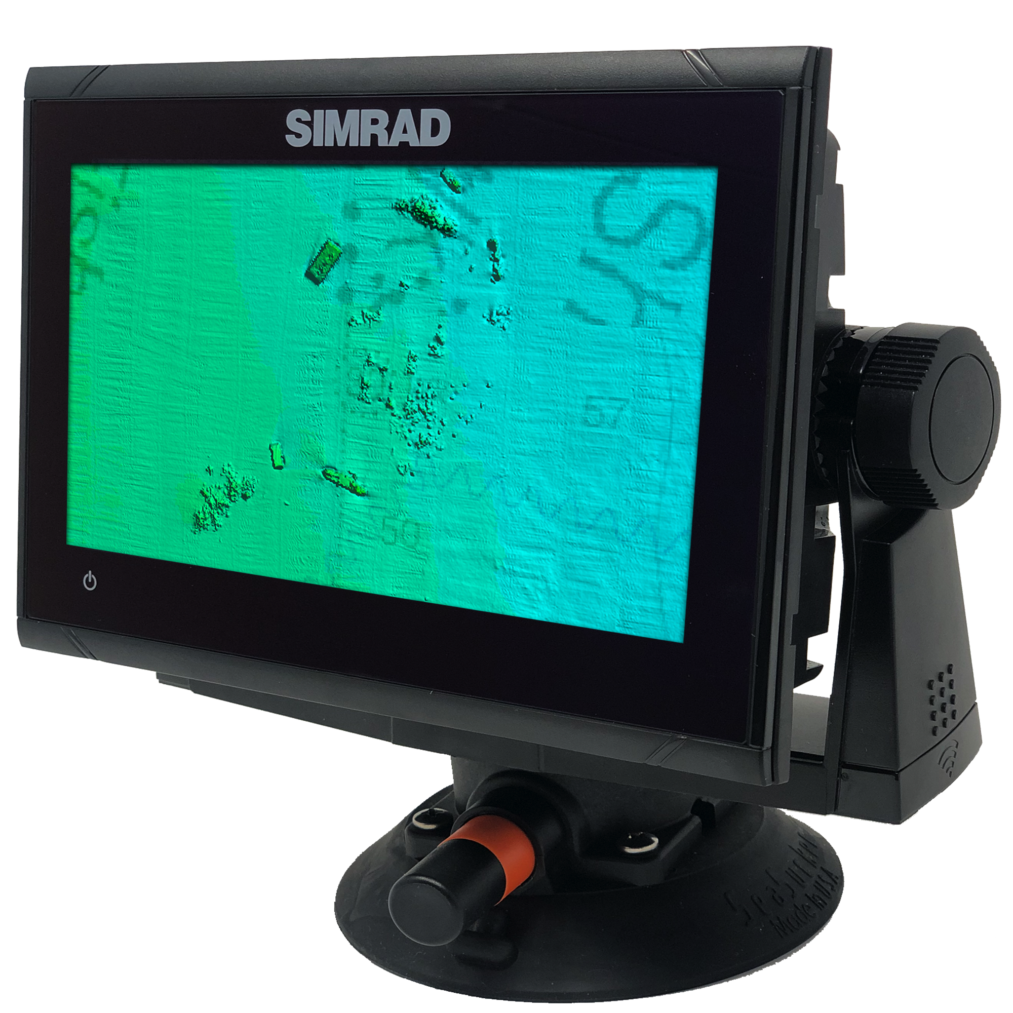
The CMOR Map Pak is the answer for all the Garmin and Furuno users who have been asking for CMOR Mapping products. We have constructed a simple but rugged solution that mounts via Seasucker to any vessel and plugs into your boats 12v cigarette lighter. This Simrad Go 9 has all of the great Simrad features such as 3D mode and is radar / sonar capable on a 9” display. The CMOR Map Pak allows you to setup and remove this GPS from your boat in under 1 minute. Whether you are powered up at home with the included power adapter, or planning the trip from the dock - this versatile GPS unit allows you to explore CMOR Charts like no other!
The CMOR Map Pak contains the following:
Simrad GO9 touch screen 9'' Chart Plotter
Two Micro-SD chart slots
Built in GPS antenna
Radar / Sonar capable
NMEA2000 to share waypoints to other chart plotters
SeaSucker suction mount
Marinco Marine 12v plug with built in fuse
Custom fit waterproof hard case
110v to 12v home power adapter
CMOR mapping cards are sold separately.
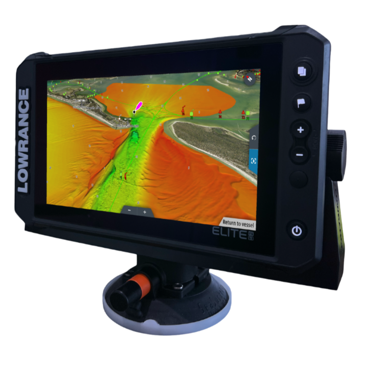
The CMOR Map Pak is the answer for all the Garmin users who have been asking for CMOR Mapping products. We have constructed a simple but rugged solution that mounts via Seasucker to any vessel and plugs into your boats 12v cigarette lighter. This Lowrance Elite FS 9 has all of the great Lowrance features such as 3D mode and is radar / sonar capable on a 9” display. The CMOR Map Pak allows you to setup and remove this GPS from your boat in under 1 minute. Whether you are powered up at home with the included power adapter, or planning the trip from the dock - this versatile GPS unit allows you to explore CMOR Charts like no other!
The CMOR Map Pak contains the following:
Lowrance Elite FS 9 touch screen 9'' Chart Plotter
Two Micro-SD chart slots
Built in GPS antenna
Radar / Sonar capable
NMEA2000 to share waypoints to other chart plotters
SeaSucker suction mount
Marinco Marine 12v plug with built in fuse
Custom fit waterproof hard case
110v to 12v home power adapter
CMOR mapping cards are sold separately.
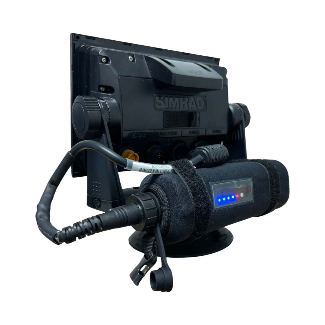
Simrad Portable Battery Kit for Map Pak!. No need for a 12v outlet anymore. Additionally, you will now have the redundancy of a fully standalone ChartPlotter.
- 10,000 mAH (10 amp Hours)
- 14.8 V
- Li - ion
- Neoprene Case
- LED Battery life indicator
- Wired to plug directly into any 4-pin powered Simrad unit
- Charger included ( Charge time approximately 2.25 hours )
- Mounts directly to any Simrad Map Pak bracket and can be easily detached for other needs.
- Can be used for electric reels ( plug sold separately )
- Powers 9 inch units up to 10 continuous hours
- Powers 7 inch units up to 12 continuous hours

Updates For Current Owners
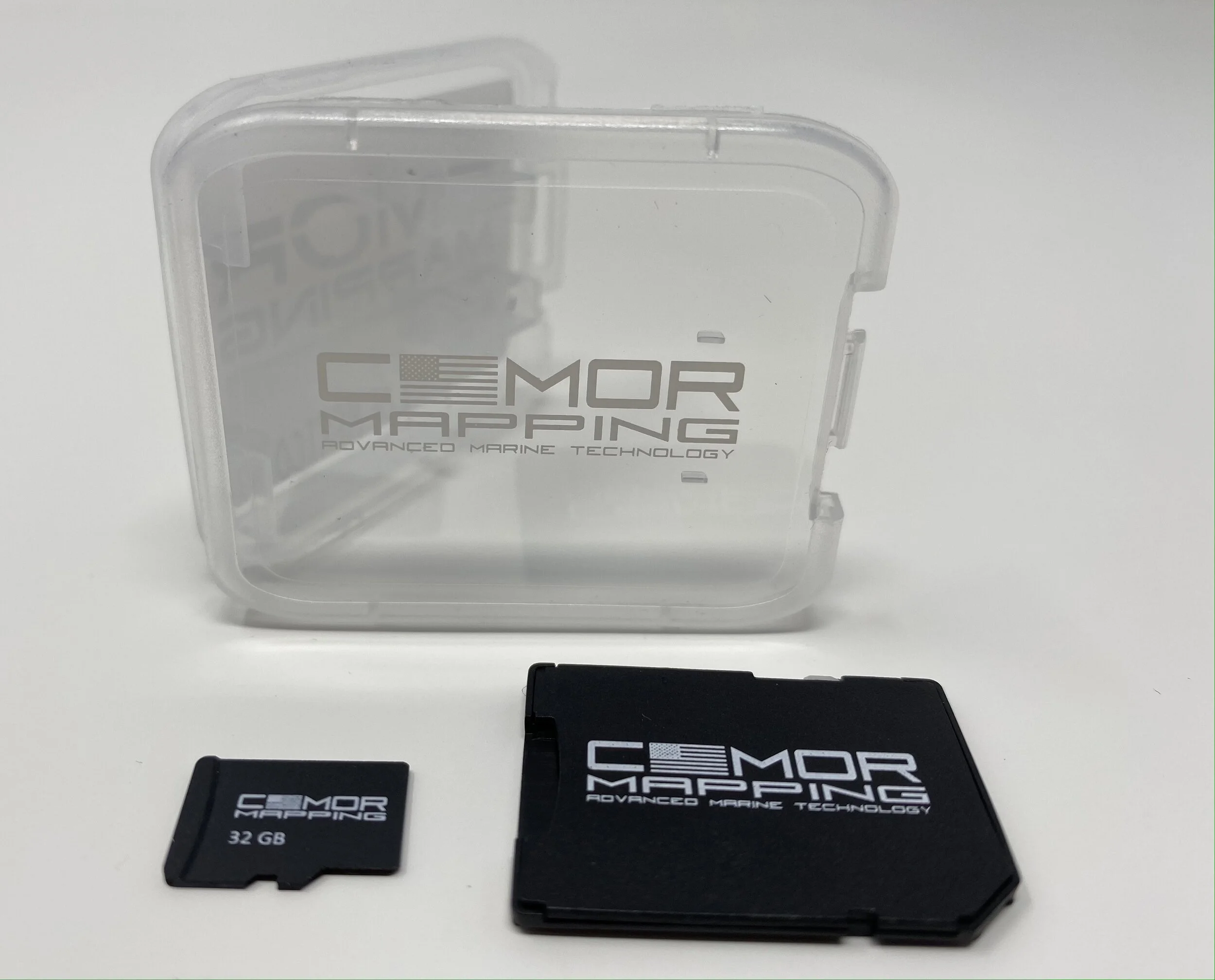
When a CMOR card is updated or expanded, we offer owners of the previous version the option to trade in their cards for the new version for $150. See below for more information on trading in your old card.
Free Updates within 60 Days of Purchase
If you purchased the previous version of your card within 60 days of the update, trade-in is free. Simply select the “Within the last 60 days” option below. You must provide your original order number to verify date of purchase. We’re open 9 a.m. to 5 p.m. Monday through Friday.
Furuno customers: The NEX GEN format is not available for Furuno, Customers will receive the latest version of sea floor data only.
Raymarine customers: NEX GEN is only compatible on Axiom + / Axiom 2 + / Axiom Pro / Axiom Pro 2 units.
WEST GULF OF AMERICA V3: Is currently only available for Simrad ( EVO / GO ) Lowrance & Mercury Vessel View units at this time. Raymarine / Simrad ( NSX / NSS4 ) and Furuno is still in the processing stage.





Introducing CMOR Next Gen South Florida V6 — the all-in-one seafloor & navigation chart.
CMOR Next Gen transcends traditional mapping by combining ultra-high resolution bathymetric imagery with full navigational data and aerial imagery — so whether you’re fishing, diving, or safe-navigating, everything you need is visible at a glance.
Visualize wrecks, reefs, artificial structure, and bottom contours while simultaneously seeing buoys, speed routes, bridges, and marinas — all tied in with the latest aerial imagery of shorelines and shallow water.
The new CMOR Nex Gen - South Florida V6 Card covers from Bethel Shoal (17 miles SSE of Sebastian Inlet) through Key West and features privately mapped data on some of the best fishing and diving spots throughout the coast, exclusively available on the CMOR Nex Gen - South Florida V6 CMOR Card. Whether you are diving for grouper and lobster, trolling for pelagics, deep drop fishing, or looking for epic swordfish, CMOR Mapping Nex Gen has coverage for everyone.
CMOR Next Gen is not just a map, it’s the complete marine view. Navigate with confidence. Fish with precision.
All CMOR Cards with the exception of Furuno are provided on Micro SD cards with a standard SD adapter included.
Furuno customers: Instead of a physical card, you will receive an unlock code to access CMOR imagery on your device. Your NavNet system ID is required in order to generate the unlock code. Also, please note that Nex Gen is not yet available for Furuno as it is in the processing stage.
Raymarine customers: Nex Gen is only compatible on Axiom + / Axiom 2 + / Axiom Pro / Axiom Pro 2 units.