NAVIGATE WITH CONFIDENCE — FISH WITH PRECISION

SOUTH FL V6 NEX GEN - WEST FL V3 NEX GEN
-
SOUTH FL V6 NEX GEN - WEST FL V3 NEX GEN -
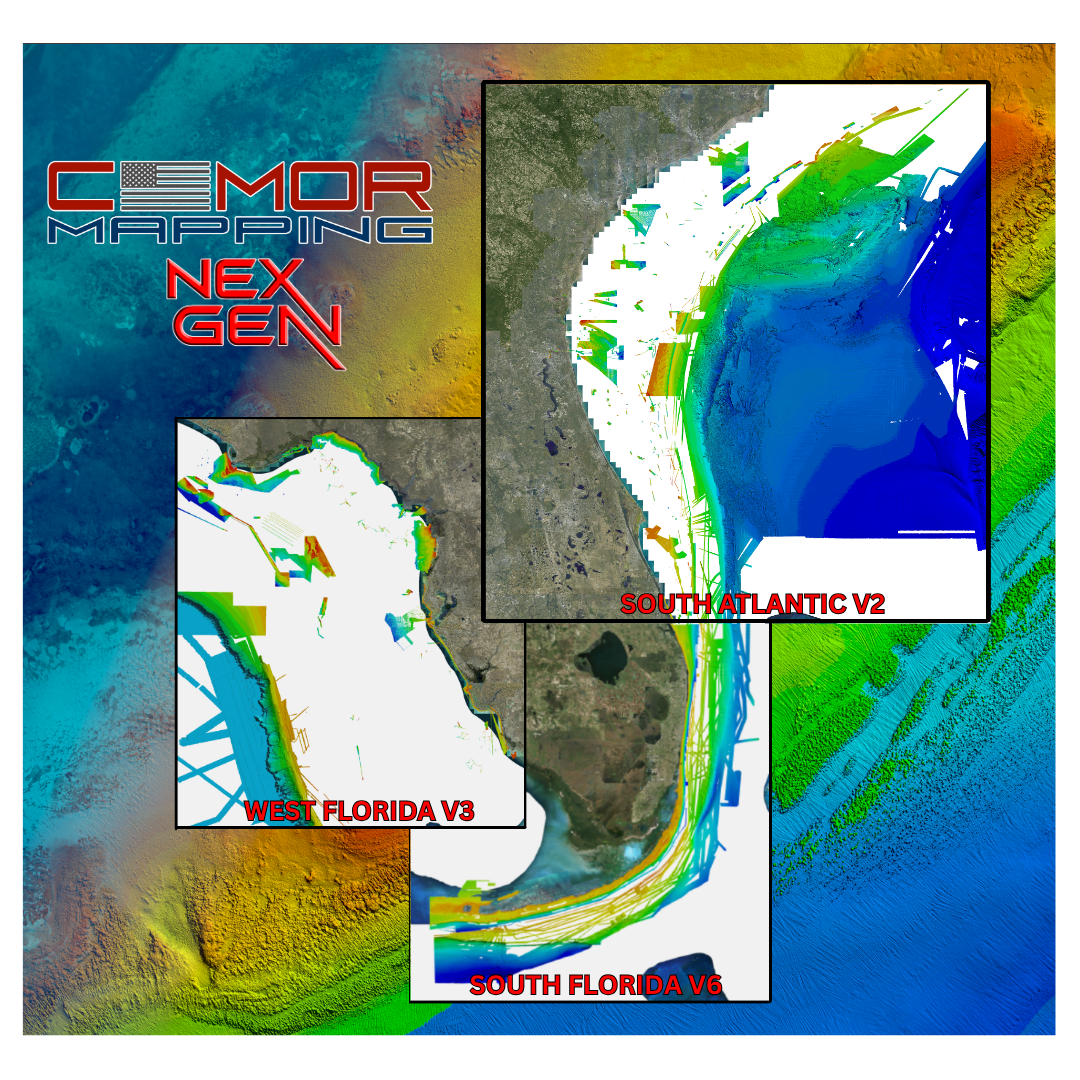
NEX GEN IS NOW AVAILABLE FOR - SOUTH FL V6 - WEST FL V3 - SOUTH ATLANTIC V2
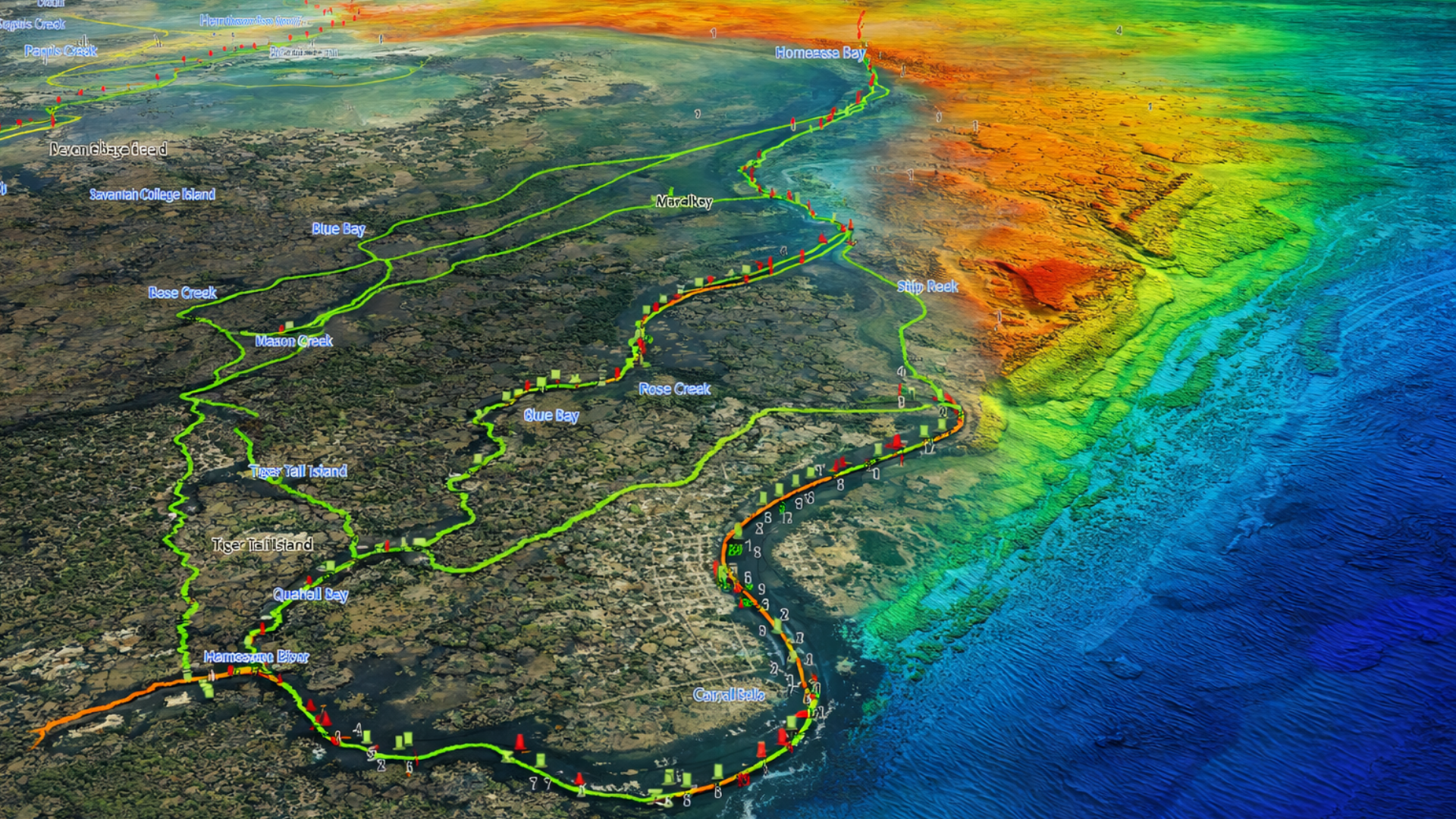
Ultra-High Resolution Bathymetry
Detailed seafloor imagery revealing subtle ledges, wrecks, rockpiles, humps, and drop-offs with clarity.
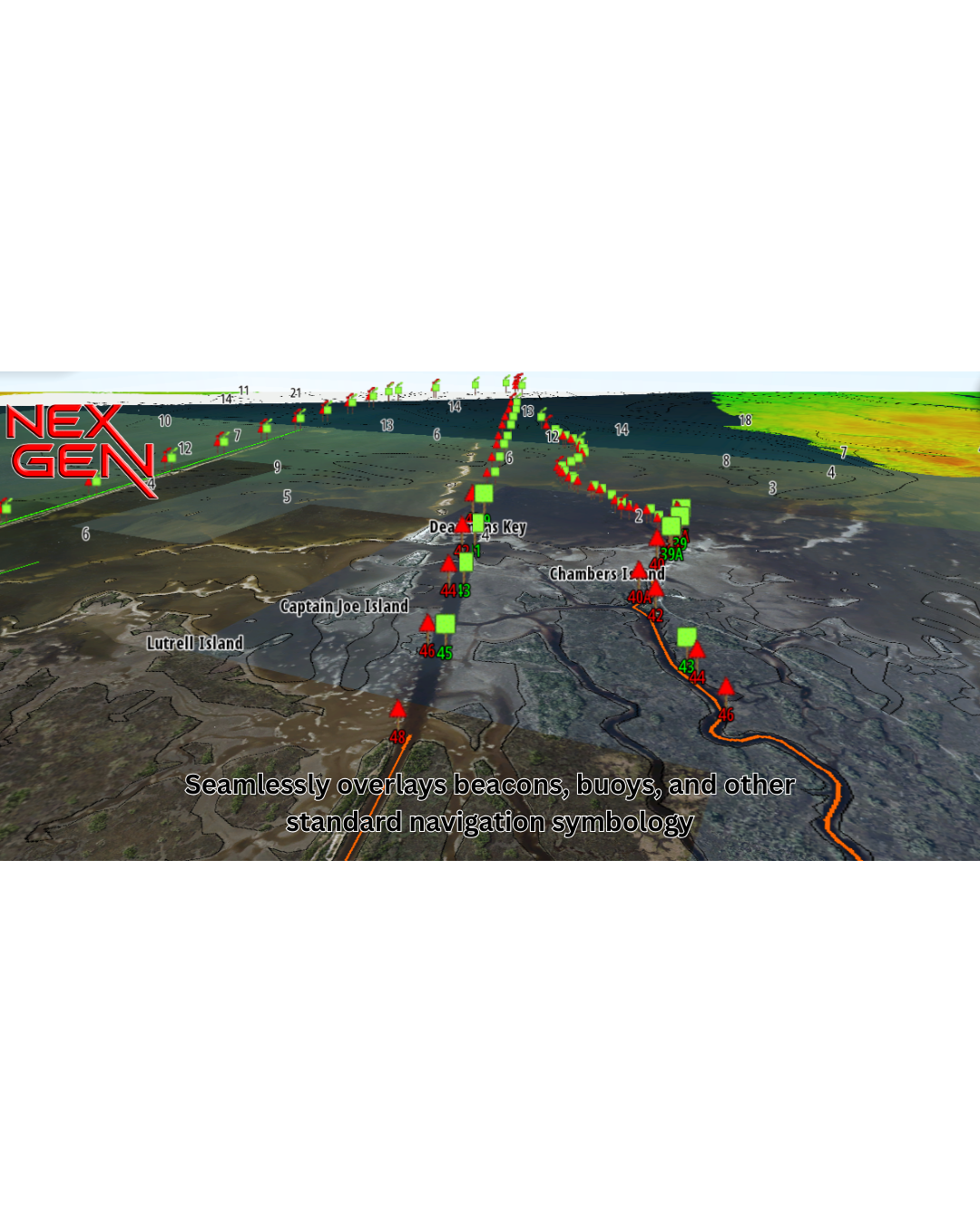
Integrated Navigational Icons & Aids
Seamlessly overlays beacons, buoys, and other standard navigation symbology — so you don’t lose reference to critical safe passage markers.
Named Wrecks, Reefs & Submerged Features
Annotated seafloor features with labels — sunken vessels, reef names, rock formations — making it easier to plan drops or dives at recognized structure.
Bridge, Marina & Infrastructure Data
Details on bridges (clearances, timings, spans) and marina layouts (slips, fuel, services).
2025 Ultra-High Resolution Satellite / Aerial Imagery Layer
True-to-life surface imagery of coastlines, islands, mangroves, docks, land use — providing visual context at a glance. Users can identify shoreline features visually, compare land vs. water, and better orient themselves.
Smart Layering & Zoom-Adaptive Display
Dynamic switching or blending of layers as you zoom in/out — full satellite imagery and bathymetry at close range, simplified base map further out — to preserve clarity and performance.
Wide Plotter Compatibility
Support for all major chartplotter brands (Raymarine, Simrad, Lowrance, Furuno, etc.) via card or file formats; backward compatibility with existing CMOR systems.
Raymarine customers: Nex Gen is only compatible on Axiom + / Axiom 2 + / Axiom Pro / Axiom Pro 2 units.
Furuno customers: Nex Gen is not yet available on Furuno units
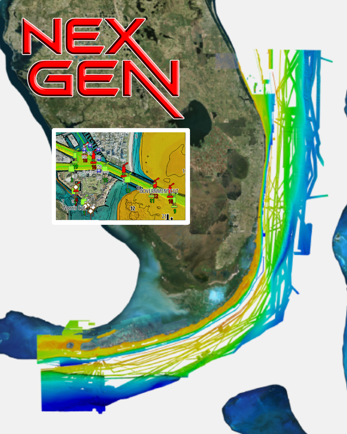
Introducing CMOR Next Gen South Florida V6 — the all-in-one seafloor & navigation chart.
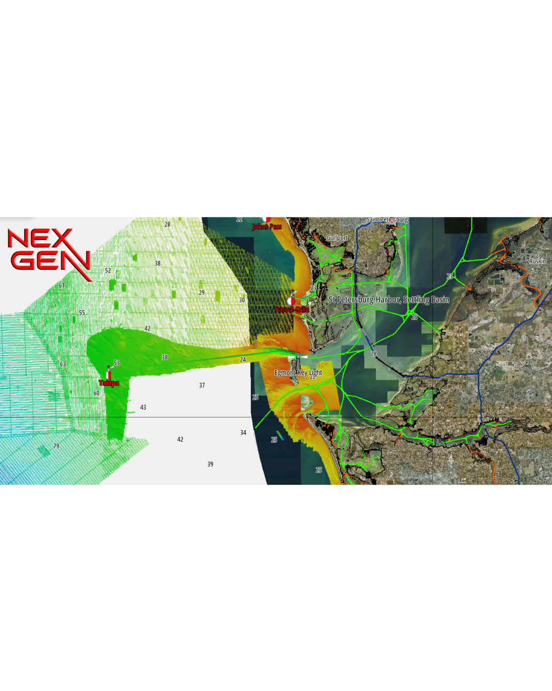
CMOR Next Gen transcends traditional mapping by combining ultra-high resolution bathymetric imagery with full navigational data and aerial imagery — so whether you’re fishing, diving, or safe-navigating, everything you need is visible at a glance.
Visualize wrecks, reefs, artificial structure, and bottom contours while simultaneously seeing buoys, speed routes, bridges, and marinas — all tied in with the latest aerial imagery of shorelines and shallow water.
The new CMOR Nex Gen - South Florida V6 Card covers from Bethel Shoal (17 miles SSE of Sebastian Inlet) through Key West and features privately mapped data on some of the best fishing and diving spots throughout the coast, exclusively available on the CMOR Nex Gen - South Florida V6 CMOR Card. Whether you are diving for grouper and lobster, trolling for pelagics, deep drop fishing, or looking for epic swordfish, CMOR Mapping Nex Gen has coverage for everyone.
CMOR Next Gen is not just a map, it’s the complete marine view. Navigate with confidence. Fish with precision.
All CMOR Cards with the exception of Furuno are provided on Micro SD cards with a standard SD adapter included.
Furuno customers: Instead of a physical card, you will receive an unlock code to access CMOR imagery on your device. Your NavNet system ID is required in order to generate the unlock code. Also, please note that Nex Gen is not yet available for Furuno as it is in the processing stage.
Raymarine customers: Nex Gen is only compatible on Axiom + / Axiom 2 + / Axiom Pro / Axiom Pro 2 units.
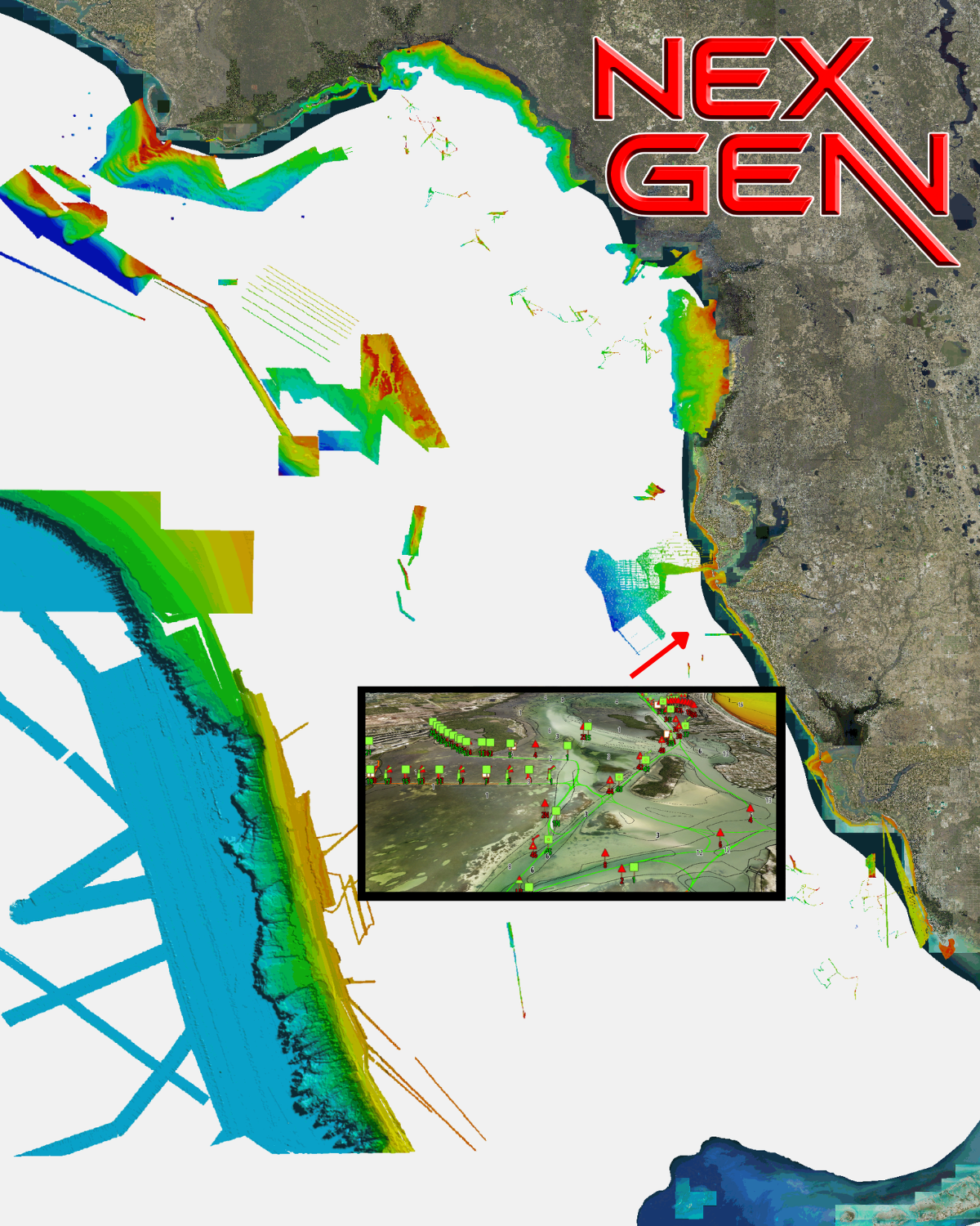
The new West Florida V3 NEX GEN 3D Relief Shading CMOR Card — a major expansion and update of the previous West Florida (Middle Grounds) CMOR Card — features major expansions of nearshore and deep drop spots, along with privately collected data from the St. Joseph Peninsula in the panhandle to Marco Island in southwest Florida. These additions have been mapped in high resolution for the first time, and exclusively on CMOR Mapping.
CMOR NEX GEN transcends traditional mapping by combining ultra-high resolution bathymetric imagery with full navigational data and aerial imagery — so whether you’re fishing, diving, or safe-navigating, everything you need is visible at a glance.
Visualize wrecks, reefs, artificial structure, and bottom contours while simultaneously seeing buoys, speed routes, bridges, and marinas — all tied in with the latest aerial imagery of shorelines and shallow water.
All CMOR Cards with the exception of Furuno are provided on Micro SD cards with a standard SD adapter included.
Furuno customers: Instead of a physical card, you will receive an unlock code to access CMOR imagery on your device. Your NavNet system ID is required in order to generate the unlock code.
Raymarine customers: Nex Gen is only compatible on Axiom + / Axiom 2 + / Axiom Pro / Axiom Pro 2 units.
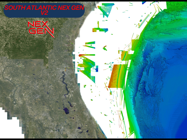
CMOR NEX GEN South Atlantic V2 COMPLETE MARINE VIEW a massive expansion of private data along with a full navigation chart throughout the coast and covers of some of the best fishing, diving, and deep dropping spots in the Atlantic Ocean. This chart has coverage from Stuart Florida up through South Carolina. Release Date 3/24/26.
CMOR NEX GEN transcends traditional mapping by combining ultra-high resolution bathymetric imagery with full navigational data and aerial imagery — so whether you’re fishing, diving, or safe-navigating, everything you need is visible at a glance.
Visualize wrecks, reefs, artificial structure, and bottom contours while simultaneously seeing buoys, speed routes, bridges, and marinas — all tied in with the latest aerial imagery of shorelines and shallow water.
All CMOR Cards with the exception of Furuno are provided on Micro SD cards with a standard SD adapter included.
Furuno customers: Instead of a physical card, you will receive an unlock code to access CMOR imagery on your device. Your NavNet system ID is required in order to generate the unlock code. Also, please note that South Atlantic is not yet available for Furuno is it is in the processing stage.
Raymarine customers: Nex Gen is only compatible on Axiom + / Axiom 2 + / Axiom Pro / Axiom Pro 2 units.